Why is it in News?
- Scientists in Mexico have produced the first high-resolution 3D interior map of Popocatépetl volcano — one of the most active and dangerous volcanoes in the world.
- The project helps identify where magma accumulates, improving eruption prediction, hazard modelling, and evacuation planning.
- Significance is high because:
- ~25 million people reside within 100 km of the volcano
- Critical infrastructure nearby includes houses, schools, hospitals, and five airports
- Earlier interior images (≈15 years ago) were low-resolution and contradictory.
Relevance
GS-1 | Geography / Geomorphology
- Volcano types, stratovolcano behaviour
- Magma chambers, tectonic-volcanic linkages
GS-3 | Disaster Management
- Hazard mapping, early-warning systems
- Risk-informed evacuation & urban-hazard planning
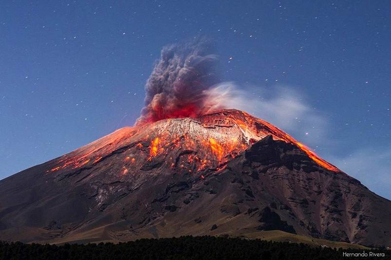
The Basics — Understanding Popocatépetl
- Location: Trans-Mexican Volcanic Belt
- Elevation: 5,452 m
- Age: current structure emerged >20,000 years ago
- Continuous activity since 1994 — ash, gas, smoke emissions almost daily
- Last major dome-collapse eruption: 2023
- Known for:
- frequent ash plumes
- lava domes that build and collapse
- pyroclastic activity risk
Popocatépetl is considered a high-risk stratovolcano due to population exposure + persistent activity.
What Did the Scientists Achieve?
- Created the first 3-dimensional cross-sectional image of the volcano’s interior
- Imaging depth: ≈18 km below the crater
- The model reveals:
- multiple magma pools at different depths
- separated by rock layers / solidified material
- greater concentration towards the southeast of the crater
- Demonstrates that magma storage is not a single chamber
→ instead a complex multi-reservoir system
Implication: Eruptions may not behave uniformly — risk patterns vary spatially.
How Was the 3D Image Created?
Seismic Imaging + AI Processing
- Inside an active volcano, magma, gases, rocks & aquifers move constantly
- Motion generates seismic vibrations
- Researchers installed seismographs that:
- record ground motion ≈100 times per second
- Massive datasets processed using AI-based inference models
- infer material type, temperature, depth, and density contrasts
Field Challenges
- Work carried out on the volcano slopes for 5 years
- Risks included:
- eruptions & explosions
- harsh weather
- damaged instruments (rats, shocks, battery failures)
- Some data sets were lost / corrupted, increasing mission difficulty
Why This Matters — Disaster Risk & Public Safety
- The new model helps:
- identify magma pathways & accumulation zones
- assess likelihood of dome formation / collapse
- improve eruption forecasting windows
- inform evacuation strategy & exclusion-zone planning
- Repeating the study periodically will allow:
- change-detection over time
- tracking magma movement before eruptions
The volcano becomes a “natural laboratory” for predictive volcanology.
Facts & Data — Key Points to Remember
- Elevation: 5,452 m
- 3D imaging depth: 18 km
- Population at risk (within 100 km): ≈ 25 million
- Active since: 1994
- Recent eruption event: 2023
- Hazards: ash plumes, dome collapse, pyroclastic activity
- Purpose of imaging: magma mapping & eruption-risk assessment
Takeaways
- Popocatépetl’s first 3D subsurface map (to 18 km) reveals multiple magma reservoirs, improving eruption prediction & disaster preparedness for ~25 million people living nearby — a major advancement in volcano monitoring using AI-enabled seismic imaging.


