Why in news ?
- IIT Gandhinagar study (Earth’s Future, March 2026) projects ~3.5% decline in Cauvery streamflow (2026–2050), contrasting sharply with increasing flows in major basins like Indus, Ganga, Krishna.
Issue in brief
- Despite projected increase in monsoon rainfall, Cauvery basin exhibits declining effective water availability, highlighting regional asymmetry of climate change impacts and decoupling of rainfall–runoff relationship in peninsular rivers.
- Historical data shows ~28% decline in streamflow (1951–2012) at Kollegal, indicating structural drying trend, not short-term variability, reinforcing concerns of long-term hydrological stress in the basin.
Relevance
- GS I (Geography): River regimes, monsoon variability, climate change impacts on peninsular rivers.
- GS III (Environment): Climate change, water stress, river basin management.
- GS II (Inter-State Relations): Cauvery dispute, federal water governance (CWDT, SC judgment).
Practice Questions
- Q1. Climate change is altering river hydrology in India with regional asymmetries. Examine with reference to the Cauvery basin. (250 words)
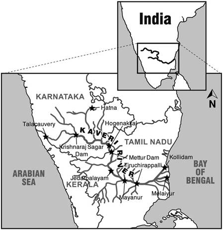
Static background – Cauvery river
- Origin at Talakaveri in Brahmagiri Hills, river length ~800 km, draining into Bay of Bengal, covering states of Karnataka, Tamil Nadu, Kerala, Puducherry.
- Major tributaries include Kabini, Hemavati, Bhavani, Harangi, supporting extensive irrigation networks and dense population, making basin highly sensitive to hydrological and climatic fluctuations.
- River depends on both South-West and North-East monsoons, increasing vulnerability to temporal variability and climate shifts, unlike Himalayan rivers with relatively stable glacial and snow-fed contributions.
Water sharing framework
- Cauvery Water Disputes Tribunal (CWDT) allocated 740 TMC ft, notified in 2013, later modified by Supreme Court of India (2018) adjusting shares between Tamil Nadu and Karnataka.
Methodological nuance – constrained vs unconstrained models
- Unconstrained CMIP6 models project ~5% increase in streamflow, but fail to capture Indian monsoon seasonality, leading to potentially misleading conclusions for regional water policy formulation.
- Constrained models (Chuphal & Mishra) filter only skillful models (8/22) matching historical observations (1951–2012), reversing projection to ~3.5% decline, enhancing policy reliability and scientific robustness.
- Demonstrates limitation of global climate models, emphasizing need for region-specific downscaling and validation, especially for monsoon-dependent basins like Cauvery with complex hydrological behaviour.
Human vs Natural dimension
- Study assesses naturalized flows (without human extraction), isolating pure climate impact, but real-world scenario includes intensive anthropogenic pressures significantly worsening water stress beyond projected decline.
- Around 80% water used in agriculture, coupled with rapid urbanisation (Bengaluru ~20 million by 2030), amplifies scarcity, making climate-induced decline a lower-bound estimate of actual stress.
Why Cauvery is drying ?
- Rising temperatures increase evapotranspiration, reducing effective runoff even with higher rainfall, altering hydrological balance and decreasing sustained river flows across seasons.
- Erratic rainfall patterns, with high-intensity short-duration events, reduce groundwater recharge and infiltration, leading to lower base flows and increased surface runoff losses.
- Dependence on dual monsoon system (SW + NE) increases exposure to inter-annual variability, making Cauvery more vulnerable compared to single-monsoon dependent basins.
Anthropogenic drivers
- Catchment degradation due to deforestation and land-use change reduces soil moisture retention and infiltration capacity, weakening natural water storage mechanisms.
- Urbanisation and infrastructure expansion lead to impervious surfaces, disrupting hydrological cycles and reducing groundwater recharge in upper catchment regions.
- Excessive groundwater extraction diminishes base flows, creating surface-groundwater disconnect, exacerbating seasonal drying and long-term decline in river discharge.
Constitutional / legal dimension
- Article 262 empowers Parliament to adjudicate inter-state river disputes, operationalised through Inter-State River Water Disputes Act, 1956, forming basis of tribunal-based resolution mechanism.
- Increasing judicial intervention by Supreme Court reflects shift from tribunalisation to judicialisation, raising concerns about institutional overlap and federal tensions.
- Fixed allocations under CWDT face challenge from dynamic climate realities, necessitating evolution towards adaptive and flexible legal frameworks for water sharing.
Governance / Federal dimension
- Cauvery Water Management Authority tasked with implementation and regulation, but suffers from limited enforcement powers, data opacity, and political non-compliance among basin states.
- Climate stress intensifies competitive federalism, where upstream–downstream conflicts escalate due to shrinking resource base and rigid allocation mechanisms.
Case study – Mekedatu dispute (2025–26)
- Karnataka proposes ₹9000 crore balancing reservoir for Bengaluru drinking water, while Tamil Nadu fears flow regulation and violation of riparian rights, escalating dispute.
- Supreme Court of India termed Tamil Nadu’s challenge “premature”, allowing Karnataka to proceed with revised DPR, highlighting legal ambiguity in anticipatory water disputes.
Economic dimension
- Cauvery delta serves as “rice bowl of Tamil Nadu”, and declining flows threaten agricultural productivity, farmer incomes, and food security in already water-stressed regions.
- Reduced flows impact hydropower generation reliability, increasing dependence on thermal energy, with implications for energy security and emissions.
- Urban water crises, especially in Bengaluru, can disrupt industrial productivity, investment climate, and service sector growth, affecting regional economic stability.
Environmental dimension
- Declining environmental flows threaten aquatic biodiversity, wetland ecosystems, and deltaic stability, particularly in ecologically fragile Cauvery delta region.
- Reduced flows increase salinity intrusion in coastal Tamil Nadu, degrading agricultural land and freshwater resources, impacting long-term sustainability.
Strategic project linkages
- Proposed Godavari–Cauvery interlinking aims to address scarcity, but raises concerns of ecological feasibility, financial cost, and interstate consensus challenges.
- Cauvery–Vaigai–Gundar link canal (Tamil Nadu) faces legal challenge from Karnataka, indicating shift from inter-state to intra-state water conflicts under scarcity conditions.
Challenges / criticisms
- Static tribunal awards incompatible with dynamic hydrological variability under climate change, leading to frequent disputes and governance challenges.
- Lack of transparent, real-time data sharing undermines trust between states and weakens effectiveness of institutional mechanisms like CWMA.
- Over-reliance on supply-side solutions (dams, links) neglects demand-side management and ecological sustainability considerations.
- Limited accuracy of regional climate projections introduces uncertainty in long-term water planning and policy decisions.
Way forward
- Transition to adaptive water-sharing frameworks based on real-time hydrological data and climate projections, ensuring flexibility and resilience in allocation mechanisms.
- Strengthen CWMA with statutory enforcement powers and transparent data systems, improving compliance, coordination, and trust among basin states.
- Promote water-use efficiency through micro-irrigation, crop diversification (millets), and pricing reforms, reducing excessive agricultural demand.
- Enhance urban water resilience via recycling, rainwater harvesting, wastewater reuse, reducing dependency on river systems for growing cities.
- Invest in indigenous climate modelling and basin-level planning, integrating IMD, IITs, and global datasets for accurate, policy-relevant projections.
- Restore catchment ecosystems through afforestation and wetland conservation, improving natural recharge, base flows, and long-term hydrological sustainability.
Prelims pointers
- Cauvery originates at Talakaveri (Karnataka) and drains into Bay of Bengal, covering four states including Puducherry (UT).
- CWDT established in 1990, final award notified in 2013, later modified by Supreme Court (2018).
- CMIP6 models represent latest generation of global climate projections, widely used in IPCC assessments.


