The ₹72,000-crore Great Nicobar Infrastructure Project has raised serious concerns over inadequate seismic risk assessment in a highly geo-dynamic region. Experts warn that the Environmental Impact Assessment downplays the threat of future mega-earthquakes and tsunamis, despite the area’s known vulnerability.
Relevance : GS 3(Infrastructure , Environment and Ecology)
Project Overview
- Cost: ₹72,000 crore
- Components:
- Transshipment port
- International airport
- Township development
- 450 MVA gas and solar-based power plant
- Clearances: Environmental and preliminary forest clearances granted by the Centre.
- Legal Challenge: National Green Tribunal (NGT) ordered a review due to ecological and tribal concerns.
Core Concerns Highlighted
EIA Study Limitations
- Conducted by Vimta Labs; based on secondary data.
- Downplays risk of mega earthquakes (like the 9.2 magnitude quake in 2004).
- Relies primarily on a 2019 IIT-Kanpur study without conducting site-specific field assessments.
- Omits critical warnings from the IIT study about accumulated strain and earthquake unpredictability.
Seismic Vulnerability
- The Andaman-Sumatra fault line is known for its history of massive earthquakes.
- The return period estimated:
- Mega-quakes (≥ 9): 420–750 years.
- Large quakes (>7.5): 80–120 years.
- Earthquake recurrence is non-linear — long silent periods may precede devastating events.
Expert Warnings
- Prof. C.P. Rajendran (NIAS, Bengaluru): GNIP is located in a “highly geo-dynamic” zone with local fault lines and unstable land elevations.
- Prof. Javed Malik (IIT-Kanpur): Highlights the need for site-specific studies, warning that seismic impacts may vary based on epicentre location (e.g., Nicobar vs. Banda Aceh).
- Sediment analysis showed 7 tsunami events in the last 8,000 years, indicating seismic volatility.
Data Gaps & Omitted Evidence
- The EIA omits key findings from the IIT study, including:
- Evidence of strain accumulation.
- A 2,000-year gap in sediment record, adding unpredictability.
- No on-ground seismic studies were conducted for GNIP, raising questions about the adequacy of risk assessments.
‘Calculated Risk’ Approach by Government
- Ministry of Earth Sciences acknowledges the lack of site-specific studies.
- Admits unpredictability of seismic events.
- Supports a “calculated risk” model — design buildings to seismic codes but proceed with development.
Ecological and Indigenous Concerns
- Potential for:
- Massive biodiversity loss.
- Tree-felling in pristine ecosystems.
- Disruption to resident indigenous tribes (e.g., Shompen).
- NGT ordered a reappraisal due to these environmental and social concerns.
Strategic Takeaways
- Strategic location of Nicobar Islands must not blindside planners to environmental and geological fragility.
- Long-term sustainability and safety require:
- Robust, site-specific seismic studies.
- Transparent, multi-disciplinary environmental assessment.
- Greater involvement of independent scientists, not just private EIA consultants.
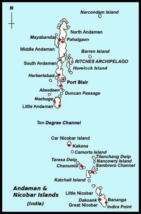
Nicobar Islands
- Part of the Andaman & Nicobar Union Territory; located in the southeastern Bay of Bengal.
- Comprise 22 islands, with Great Nicobar being the largest.
- Home to ecologically sensitive zones and tribal reserves (e.g., the Shompen tribe).
- Lies along the Andaman-Sumatra subduction zone, a seismically active fault line.
- Rich in biodiversity, designated as part of a UNESCO Biosphere Reserve.
- Strategically located near the Malacca Strait, a key global maritime chokepoint.
- Infrastructure development is restricted due to environmental, tribal, and geological vulnerabilities.


