Why is it in News?
- Recent analysis highlights repeated breaches of Kosi embankments (latest in 2024), reviving debate on whether embankments worsen floods instead of preventing them.
- New studies and expert committees point to 120 km westward shift of the Kosi in 250 years due to sedimentation and engineering interventions.
- NDA’s “Flood to Fortune” promise and the Kosi-Mechi river-linking project have brought embankment policy back into political and ecological focus.
Relevance
GS-I: Geography
- River morphology; meandering rivers; sediment load; avulsion dynamics.
- Himalayan rivers’ hydrology and shifting channels.
GS-III: Disaster Management
- Embankment breaches increasing flood intensity; risk amplification.
- Structural vs non-structural flood mitigation approaches.
GS-III: Environment
- Human interventions altering natural river behaviour.
- Siltation, upstream catchment changes, climate variability impacts.
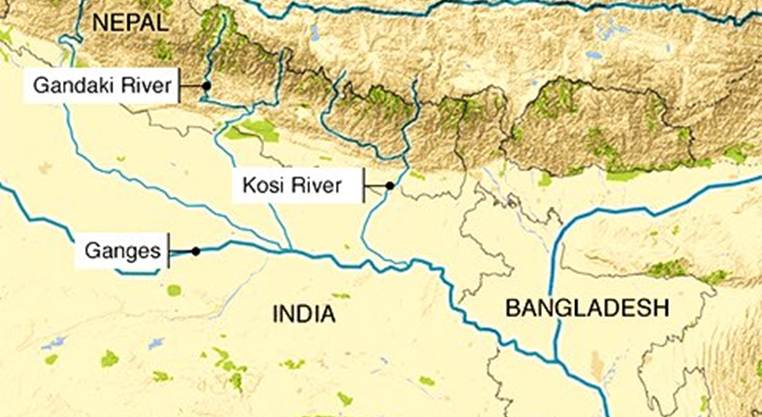
Understanding the Kosi River
- Origin: Tibet & Nepal; joins Ganga in Bihar.
- Called Sapta Kosi due to seven tributaries.
- Highly dynamic, one of world’s most sediment-loaded rivers.
- Known as “River of Sorrow” due to catastrophic floods and course shifts.
- Has shifted course ~120 km west over the last 250 years (People’s Commission on Kosi Basin).
Why Kosi Causes Extreme Flood Vulnerability ?
- High sediment load → riverbed aggradation.
- Dynamic course → frequent channel shifts.
- Low-gradient plains → sluggish flow, high inundation.
- Monsoon-fed system → sudden surge in discharge.
- Flood peaks: ~6 lakh cusecs (2024 flood).
Embankments: Intended Role
- Artificial levees to contain floodwaters.
- Aim: protect settlements, stabilize agriculture, allow development.
- Built extensively since 1950s in Bihar and Assam.
Issues with Embankments
Increased Siltation
- Embankments trap silt inside the confined channel → riverbed rises continually.
- Over time, river flows at a higher elevation than surrounding land, making breaches catastrophic.
- G.R. Garg Committee (1951) warned embankments are risky for silt-heavy rivers.
Frequent Breaches
- Kosi breached embankments in 1963, 1968, 1971, 1980, 1984, 1987, 1991, 2008, 2024.
- Breaches create sudden, unpredictable inundation over vast areas.
Water Logging Outside Embankments
- Poor drainage → stagnant water in villages trapped between embankments.
- Creates chronic flooding even without major river spillage.
Loss of Ecological Function
- Rivers lose:
- natural drainage roles
- floodplain recharge
- sediment redistribution
- wetland replenishment
- Leads to biodiversity loss and groundwater decline.
Short-term protection, long-term vulnerability
- Embankments need continuous raising as silt accumulates.
- High maintenance costs; frequent failures.
- “False sense of security” leads to unsafe development in floodplains.
Impact on Agriculture
- Deposition of coarse silt/sand during breaches (seen in Assam & Kosi belt).
- Loss of fertile topsoil → agrarian distress.
Himalayan Context: Why East is More Vulnerable
- Eastern Himalayan rivers (Kosi, Brahmaputra): affluent rivers
- precipitation increases downstream
- high sediment → higher breach probability
- geologically weak terrain → landslides, river shifts
- Western Himalayan rivers: influent rivers
- rainfall decreases downstream
- more stable → embankments relatively safer
Key Expert Views
- E. Somanathan: Embankments initially help but later turn dangerous due to rising riverbed; recommends floodplain-based resilience and removal where feasible.
- Rahul Yaduka: Embankments serve development aims but cause waterlogging; suggests improving palaeochannels for natural water distribution.
- Bindhy W. Pandey: Embankments unsuitable for eastern Himalayan rivers; require strict monitoring & rehabilitation if used.
- Mahendra Yadav (Kosi Nav Nirman Manch): Advocates “living with floods” + rehabilitating people outside embankments.
Case Study: 2008 Kosi Catastrophe
- Breach at Kusaha (Nepal).
- Deaths: 400+
- People affected: 33 lakh
- Caused by silt accumulation, embankment ageing, and altered flow due to barrage.
Kosi–Mechi River-Linking Debate
Government’s Argument
- Provide irrigation to Mahananda basin.
- Promote fisheries and agriculture.
- NDA’s “Flood to Fortune” political pitch.
Expert Counterpoints
- Kosi peak flow: ~6 lakh cusecs
- Diversion through project: 5,247 cusecs → negligible impact on flood moderation.
- Linking won’t reduce flood peaks; may worsen siltation and cross-basin flooding.
Economic Concerns
- Embankments require rising annual expenditure.
- Bihar’s embankment-related spending has increased multiple times since 1950s.
- High budget consumption with low resilience gain.
Global Lessons
United States
- Actively removing embankments in many basins.
- Allowing controlled flooding to restore:
- floodplains
- wetlands
- ecosystem integrity
- Result: milder floods, better ecological recovery.
Alternatives & Way Forward
1. Living with Floods
- Restore natural floodplains.
- Zoned habitation.
- Seasonal cropping patterns aligned with flood cycles.
2. Reviving Palaeochannels
- Use abandoned channels to redistribute floodwaters.
- Reduce pressure on main embankment.
3. River Basin Governance
- Basin-wide planning
- Cross-border coordination with Nepal
- Sediment management strategy
4. Early Warning & Evacuation
- Training communities inside embankment belts.
- Improving forecasting systems.
5. Scientific Desiltation
- Targeted removal at critical nodes.
- Must be ecology-sensitive; avoid indiscriminate sand mining.


