Context:
Several houses and buildings were damaged after an earthquake of magnitude 6.4 on the Richter scale hit Assam.
Six aftershocks, of magnitude ranging from 3.2 to 4.7, occurred in the two-and-a-half hours following the main tremor.
Relevance:
GS-III: Disaster Management (Earthquakes) GS-I: Geography (Important Geophysical Phenomena)
Dimensions of the Article:
- About the Fault line involving Assam Earthquake
- About Himalayan Frontal Thrust (HFT)
- Earthquake zones of India
- Back to the basics
About the Fault line involving Assam Earthquake
- The primary earthquake had its epicentre at about 80 km northeast of Guwahati, and a focal depth of 17 km, the National Centre for Seismology (NCS) said.
- The preliminary analysis shows that the events are located near to Kopili Fault closer to Himalayan Frontal Thrust (HFT).
- The area is seismically very active falling in the highest Seismic Hazard zone V associated with collisional tectonics where Indian plate sub-ducts beneath the Eurasian Plate.
- When an earthquake occurs on one of these faults, the rock on one side of the fault slips with respect to the other. The fault surface can be vertical, horizontal, or at some angle to the surface of the earth.
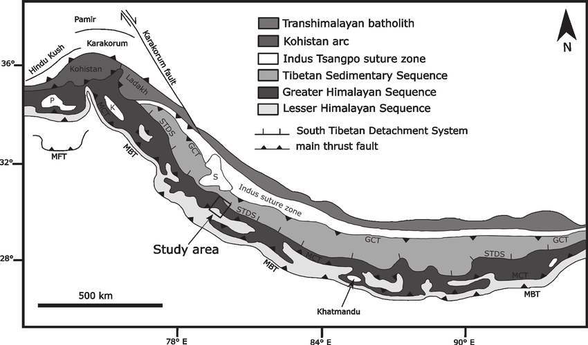
About Himalayan Frontal Thrust (HFT)
- The Main Frontal Thrust (MFT), also known as the Himalayan Frontal Thrust (HFT) is a geological fault in the Himalayas that defines the boundary between the Indian and Eurasian Plates.
- The fault is well expressed on the surface thus could be seen via satellite imagery.
- It is the youngest and southernmost thrust structure in the Himalaya deformation front. It is a splay branch of the Main Himalayan Thrust (MHT) as the root décollement.
- It runs parallel to other major splays of the MHT; Main Boundary Thrust (MBT) and Main Central Thrust (MCT).
- The MFT accommodates almost the entire rate of subduction of the Indian Plate therefore, it is no surprise that numerous earthquakes have occurred along this fault, and is expected to produce very big earthquakes in the future.
- Many earthquakes associated with the MFT has resulted in visible ground ruptures, as seen in the Bihar earthquake of 1934 and 1505 magnitude 8.9 earthquake.
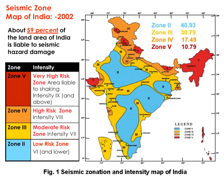
Earthquake zones of India
- The major reason for the high frequency and intensity of the earthquakes is that the Indian plate is driving into Asia at a rate of approximately 47 mm/year.
- Geographical statistics of India show that more than 50% of the land is vulnerable to earthquakes.
- The latest version of seismic zoning map of India divides India into 4 seismic zones (Zone 2, 3, 4 and 5).
Zones of Seismicity
- Zone 1: Currently the Division does not include a Zone 1. NO area of India is classed as Zone 1.
- Zone 2: This region is liable to MSK VI or less and is classified as the Low Damage Risk Zone.
- Zone 3: This zone is classified as Moderate Damage Risk Zone which is liable to MSK VII.
- Zone 4: This zone is called the High Damage Risk Zone and covers areas liable to MSK VIII. Jammu and Kashmir, Ladakh, Himachal Pradesh, Uttarakhand, Sikkim, the parts of Indo-Gangetic plains (North Punjab, Chandigarh, Western Uttar Pradesh, Terai, North Bengal, Sundarbans) and the capital of the country Delhi fall in Zone 4.
- Zone 5: Zone 5 covers the areas with the highest risks zone that suffers earthquakes of intensity MSK IX or greater. The region of Kashmir, the Western and Central Himalayas, North and Middle Bihar, the North-East Indian region, the Rann of Kutch and the Andaman and Nicobar group of islands fall in this zone.
Back to the basics: Click Here to read more about Earthquakes, Earthquake waves and how they are measured
-Source: Indian Express


