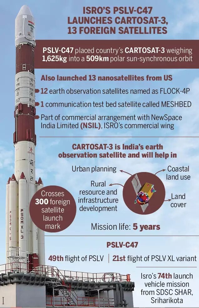
India’s Polar Satellite Launch Vehicle, PSLV-C47 has launched Cartosat-3 and 13 commercial nanosatellites into Sun Synchronous orbit from Satish Dhawan Space Centre (SDSC) SHAR, Sriharikota.
Details:
It is a third-generation agile advanced earth observation satellite with high-resolution imaging capability.
Developed by the Indian Space Research Organization (Isro), it will replace the IRS series.
It will be placed in an orbit of 509 km at an inclination of 97.5 degree.
Till date, eight Cartosats have been launched by ISRO.
Applications
- Data from most of the Cartosat satellites are exclusively used by the armed forces.
- However, an existing policy allows only government and government authorised agencies to access ISRO’s high-resolution imageries below a resolution of 1 metre.
- Cartosat-3’s optical imaging will also help to detect precise cartographic or mapping activities.
- The imageries are also used for urban and rural infrastructure planning, coastal land use and regulation, utility management such as monitoring road networks, water grids or distribution, creation of land use maps, disaster management, etc.
Background:
- The Cartosat satellites are earth observation satellites, used mainly for large-scale mapping of the Earth through high-resolution cameras.
- It also helps to detect changes in natural geographical or man-made features. As their cameras can `look back and forth’ in an angle to generate continuous spot images.
- The Earth-observation satellites also include the Resourcesat and RISAT series, the Oceansat series.
- The Resourcesat and RISAT series of satellites, for example, provide images and data that are needed for land and water resources applications.
- The Oceansat series and the SARAL satellite, meanwhile, produce data on the oceans.
- The satellites like INSAT 3D, INSAT-VRR or Megha Tropiques study the atmosphere.


