Why in news?
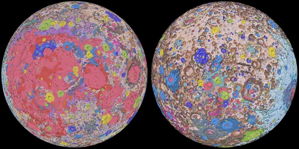
The first ever digital, unified, global, geological map of the moon was released virtually by the United States Geological Survey (USGS), National Aeronautics and Space Administration (NASA) and the Lunar Planetary Institute on April 22, 2020.
Details
- Data from recent satellite missions to the moon and resources data from NASA’s Apollo Missions were used to come up with the map. This map is a culmination of a decades-long project.
- Surface features of the moon included crater rim crests, buried crater rim crests, fissures, grabens, scarps, mare wrinkle ridges, faults, troughs, rilles, and lineaments.
- The moon’s South Pole is especially interesting because the area is much larger than the North Pole and there could be possibility of presence of water in these permanently shadowed areas. Further, the South Pole region also contains the fossil record of the early Solar System.
What is the use of the Map?
- Called the ‘Unified Geologic Map of the Moon’, it will serve as a blueprint for future human missions and a source of research and analysis for the educators and the general public interested in lunar geology.
- The Map will help NASA with their planning for future missions.
- It provides vital information for new scientific studies by connecting the exploration of specific sites on the moon with the rest of the lunar surface.
- The Indian Space Research Organisation (ISRO) Chandrayaan 2, is an active mission that targets the Lunar South Pole for exploration.
- Like Chandrayan, other moon missions like the Artemis (human spaceflight programme), that is a crewed exploration programme of Nasa, plan to send humans to the Lunar South Pole by 2024 and in due course of time, establish a permanent presence on the moon.


